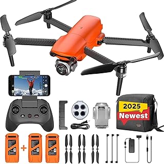
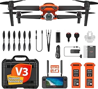
Autel Drones for Professionals: Advanced Drone Capabilities
Autel Robotics is a leading drone manufacturer known for its professional-grade drones, offering a range of features and capabilities designed for diverse applications. Here's a breakdown of the advanced capabilities you can expect from Autel drones:
1. Powerful Flight Performance:
* Extended Flight Time: Autel drones boast impressive flight times, allowing for longer missions and data collection. Some models, like the Evo II series, offer up to 50 minutes of flight time, making them suitable for extensive aerial surveys and inspections.
* High-Speed Flight: Certain models, such as the Evo II Pro and Evo II Pro 6K, can reach speeds of up to 72 km/h, enabling efficient coverage of large areas and faster mission completion.
* Advanced Obstacle Avoidance: Autel drones leverage sophisticated obstacle avoidance systems, including multiple sensors and AI-powered algorithms, ensuring safe and autonomous flight in complex environments.
2. High-Resolution Imaging and Video Capture:
* Ultra-High-Resolution Cameras: Autel drones are equipped with advanced camera systems capable of capturing stunning visuals. The Evo II Pro 6K, for instance, features a 6K camera, while the Evo II Pro boasts a 50MP sensor, delivering exceptional detail and clarity.
* Zoom Capabilities: Autel offers models with powerful optical zoom capabilities, enabling you to capture distant details without compromising image quality.
* Thermal Imaging: Some Autel drones, like the Evo II Thermal, are equipped with high-performance thermal cameras, allowing for efficient heat detection and analysis in various applications, including search and rescue, infrastructure inspection, and wildlife monitoring.
3. Smart Flight Modes and Features:
* Autonomous Flight Modes: Autel drones come equipped with intelligent flight modes like Waypoint Flight, which enables pre-programmed flight paths for precise data collection. Other modes, such as Orbit and Track, allow for automatic circling around a subject or following a moving object.
* Advanced Flight Control: Autel's drones offer precise control and stability thanks to advanced flight control algorithms and a robust communication system.
* Real-Time Data Transmission: Autel drones feature high-bandwidth video and data transmission capabilities, enabling real-time streaming and control, even at long distances.
4. Powerful Software and Data Analysis:
* Autel Sky App: The user-friendly Autel Sky app provides comprehensive control over your drone, offering intuitive flight management, real-time camera settings adjustments, and direct access to captured data.
* Data Processing and Analysis: Autel drones integrate seamlessly with third-party software for advanced data processing and analysis, allowing for creating detailed reports and visualizations from captured images and videos.
5. Industry-Specific Solutions:
Autel drones are designed for various professional applications, including:
* Surveying and Mapping: Precision mapping, topographic surveys, and 3D modeling for construction, agriculture, and urban planning.
* Inspection and Monitoring: Infrastructure inspection, power line assessment, pipeline monitoring, and industrial facility inspection.
* Search and Rescue: Aerial surveillance, thermal imaging, and data collection for locating missing persons or aiding emergency responders.
* Photography and Videography: High-quality aerial imagery and video for film production, real estate photography, and tourism.
* Law Enforcement and Security: Aerial reconnaissance, evidence gathering, and perimeter monitoring for crime scene investigation and security operations.
Choosing the Right Autel Drone:
Autel offers a diverse range of drones, each suited for specific applications. Consider your needs, budget, and intended use case to choose the model that best fits your requirements.
By providing advanced capabilities, user-friendly software, and robust support, Autel drones empower professionals across various industries to achieve greater efficiency, accuracy, and insights from their aerial operations.


